Race Preview: 2013 Outer Banks Marathon

 Hey, guess what? I’m running the Outer Banks Marathon on Sunday, November 1oth. If you’ve read my posts over the past four months, then you are probably tired of hearing about my preparation. I understand. I am certainly tired of training! Here’s some information on what I’ll be facing on Sunday.
Why Outer Banks?
After my disappointing second half on the killer hills of last March’s Columbia Marathon, I decided I wanted to go back to the coast for a flat marathon. My personal best was at Myrtle Beach in 2011. I also wanted a fall race, where most training would be in the summer heat, but race day would be cooler. This is the opposite of spring races where I’ve trained in the cold only to be hit with too warm conditions late in the race.
So, given those requirements, a few close races meet the mark. There is Kiawah Island near Charleston, SC in December. Also, there are two November races, Savannah (Georgia) Rock ‘n Roll and Outer Banks, North Carolina. I decided Kiawah was too close to Christmas and, besides, I’d done it once. So, that left the other two. Despite not visiting Savannah in quite some time, I decided to go to Outer Banks, where I’ve never visited.
The Course
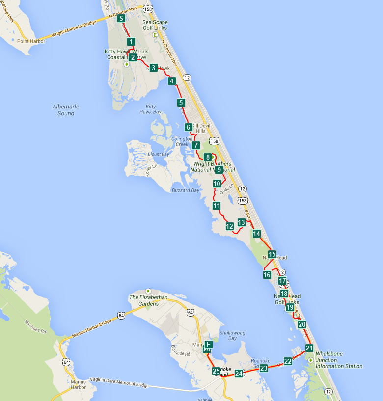
The course is a point to point layout, mostly north to south. At least it is not a double loop. We’ll start in Kitty Hawk and end with trip over the Washington-Baum bridge into Manteo for the finish. Here’s a picture, courtesy of TazRunning.com:
For a slideshow tour of the course, click here: http://obxrunners.appspot.com/route/agpvYnhydW5uZXJzcgsLEgVSb3V0ZRgBDA/play
For videos of the sections of the course by Village Realty, click here: http://www.youtube.com/playlist?list=PLC0DEB5774A8B363B
Elevation Changes
While the course is extremely flat compared to the Columbia Marathon and my usual training routes, there are two spots that will make it harder for me to reach my goal of qualifying for the Boston Marathon. The first is around mile 10. The course organizers decided to showcase some local trails and threw in about a 5K’s worth of cross country running. The first 2 to 2.5 miles of this appears to be on hard packed dirt roads, but we take a turn about the 12.5 mark onto mulch covered sand dunes trails. Hmmm. Sounds like quicksand to me.
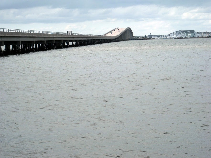
The second point of concern is around the 22-23 mile mark, the Washington-Baum bridge over Roanoke Sound. On the elevation map, it is barely a blip, but at mile 23 it will seem like Mount Everest.
Here’s the elevation map for the entire course (courtesy of FindMyMarathon.com):
Weather
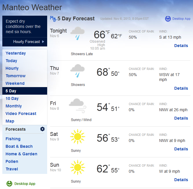
Looks like my plan for perfect running weather is looking good. I run best with temps in the 50’s. Here’s the forecast for Sunday:
Personal Goal
My goal for this race is to beat 3:25:00. This is over 22 minutes faster than my previous marathon best and would qualify me for the Boston Marathon. The goal may be quite a stretch, but my training has come together nicely over the last two months. I’ve completed all my planned workouts and feel great. It is gonna be close. Click on the image below for more details on my training with the Run Less Run Faster program.
Now I just have to make it to the starting line. I’ve made some planning and logistics mistakes, but that’s another story.
Now I’m off to complete my playlist…
POFIFOTO!


Thanks for sharing about the experience! Hope you enjoyed the running event.
Susan,
I guess I didn’t do much of a review on the actual event. I enjoyed it very much. It seemed to be well organized and the post race festivities in Manteo were excellent. We had a wonderful time when we actually arrived there! I tell people its a very good event. Just flatten out that bridge! 🙂